


BAKER CITY, Ore. (AP) - On the far side of Oregon, among rolling prairie and high desert, are some of the state’s most spectacular but overlooked places.
Eastern Oregon is home to a colorful collection of mountains with names such as Wallowa, Blue, Strawberry and Steens - places of sweeping alpine topography and oddball geology - that are visited far less than their brethren on the west side.
The best way to experience these wild and beautiful mountains is with a backpacking trip. Mountain lakes, meadows and wind-swept peaks are best experienced with a few days of up-close enjoyment.
Here are the top five places for a backpacking adventure in Eastern Oregon.
5: GEARHART MOUNTAIN WILDERNESS
Where the heck is Gearhart Mountain?
That, I suspect, is most Oregonians’ question when first hearing of this wilderness area east of Klamath Falls in the Fremont-Winema National Forest.
Highlighted by pearl-white rock formations, a cliff-walled valley and deep-blue lake surrounded by quaking aspen, the Gearhart is a place of deep solitude in the desolate southeast.
The best backpacking route is a 13-mile trail that bisects the wilderness from one end to the other. A shuttle isn’t difficult to set up with two cars, but there’s an out-and-back option as well.
From Lookout Rock Trailhead, the trail quickly reaches the Palisades, a collection of oddly shaped rock towers that with the right eyes, resemble characters from Lord of the Rings. You can find dwarfs, hobbits, dragons and wizards in the towers created by porphyritic lava flows.
The trail climbs to a pass just below Gearhart Mountain before dropping into a spectacular cliff-walled valley at mile 5.5. Camp here and spend the day exploring the valley or take a non-technical climb to the 8,370 foot summit of the wilderness’ namesake peak. If you haven’t set up a shuttle, the valley is your turn-around spot.
Beyond, the trail travels through a patch of forest ravaged by the mountain pine beetle - making it look pretty dead - before dropping to Blue Lake, a good fishing and camping spot. The trail wraps up along the North Fork of the Sprague River, among swaying aspen that turn brilliant gold in autumn.
The route is 13 miles with 2,054 feet of climb one-way, or 11 miles out and back to the valley, with 1,800 feet of climb.
Directions (Lookout Rock Trailhead): From Klamath Falls, follow OR 140 east for 55 miles to the tiny hamlet of Bly. About 1 mile past Bly, turn left onto Campbell Road for a quick 0.5 mile, then turn right onto Road 34, following the sign for the Gearhart Mountain Wilderness. Follow the paved road 16 miles toward the mountain, and turn left at the sign for Corral Creek Campground (Road 212). Follow this increasingly rough gravel road, past the campground, a total of 1.5 miles to the trailhead. The final 0.5 mile is rough and may be difficult for low-clearance passenger cars. Coordinates: N42 27.637’ W120 48.061’
Directions (Blue Lake Trailhead): From the Corral Creek Road turnoff, drive another 4 miles on Road 34 to a four-way intersection. Turn left onto FR 3428, following the sign to Lee Thomas Campground. Five miles farther, past a little shady canyon, arrive at a turnoff to the left. A badly faded, almost impossible-to-read sign says “Blue Lake.” Continue for 3 miles on the side road, through a large burn and logging area to the trailhead. Coordinates: N42 33.496’ W120 50.482’.
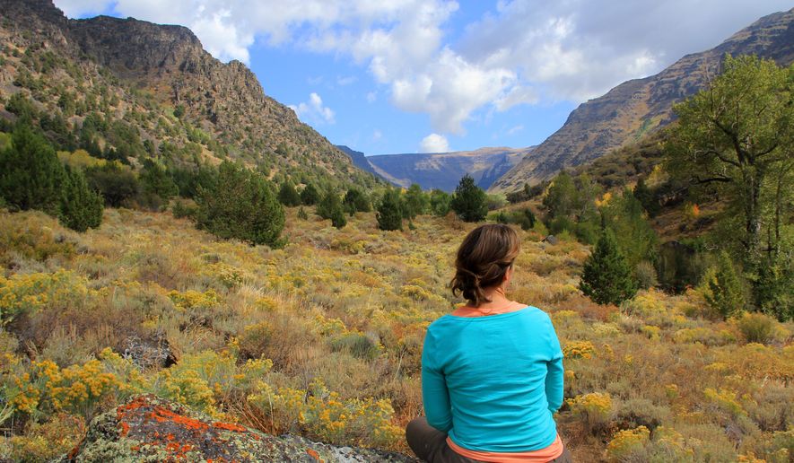
4: BIG INDIAN GORGE (STEENS MOUNTAIN)
Wide, deep and rich with color, Big Indian Gorge is the most visually stunning of the accessible canyons in southeast Oregon’s Steens Mountain.
But reaching it does require some work.
South Steens Campground, home to running water and 36 sites, is the trailhead for Big Indian Gorge. The trail begins with 1.9 miles on an old road, through grassy meadows and below wide-open sky, to the first of three stream crossings. The crossings are 10 to 15 feet wide and require careful footwork.
Beyond the crossings, the scenery ramps up as the trail swings east into the mouth of the canyon. The entire gorge sweeps out in a massive U-shaped landscape carpeted with sagebrush, aspen and juniper.
There are places for lunch along the trail and a fantastic campsite among a grove of cottonwood trees at the 6.5-mile mark. The trail quits after 8.5 miles near a headwall where Steens Mountain’s summit looms above. With a bit of exploring, waterfalls sprouting from the headwall can be found.
The full route is 17 miles out and back, with 2,000 feet of climb. It’s 13 miles out and back to Cottonwood Camp.
Directions: From Burns, follow Highway 205 south for 61 miles to Frenchglen. Then continue another 10 miles south toward Fields. Turn left onto Steens Mountain Loop Road, a fairly bumpy gravel road, for 19 miles to South Steens Campground. The trailhead is in the back of the family campground area. Coordinates: N42 39.381 W118 43.388.
3: ELKHORN CREST TRAIL
Views across the length of northeast Oregon feel almost commonplace on the Elkhorn Crest Trail, one of the highest and most unique pathways in the state.
The 23-mile national recreation trail tightropes across the granite spine of the Elkhorn Range, where mountain goats roam sheer peaks and alpine lakes dapple multicolored valleys high above the prairie below.
Located outside Baker City, the trail stretches from one high pass to another - staying close to 8,000 feet throughout - on a fairly level route between trailheads at Anthony Lake Campground and Marble Pass. For those who love alpine backpacking but don’t enjoy steep climbs and drops, the Elkhorn Crest is tough to beat.
Backpackers typically tent at Dutch Flat, Lost, Meadow, Summit and Twin lakes just off the main trail. Water and flat ground is rare on the crest.
The recommended route for backpacking all 23 miles is to begin at Marble Pass, which eliminates the one steep climb on the route.
To save time, money and gas - and to avoid driving the awful roads to Marble Pass - consider getting a shuttle. Range Tour and Shuttle in Baker City charges $50 per backpacker and can be reached at (541) 403-2616 or rangetour@gmail.com.
More than half the trail is open to mountain bikes and the occasional motorcycle, since only part of the trial is within the North Fork John Day Wilderness.
Directions to Anthony Lake: From I-84 between La Grande and Baker City, take Exit 285 in North Powder. In North Powder, follow the ski area signs on Highway 237 for 4 miles to Ellis Road. Turn left on Ellis Road and go about 1 mile to the Anthony Lake Highway. Turn right and follow the Anthony Lake Highway (becomes Forest Road 73) for 16 miles to campground entrance on your left. Coordinates: N44 57.751, W118 13.714.
Directions to Marble Pass: The roads to this high pass are awful, and only high-clearance vehicles should attempt this drive. From Baker City, go north on Highway 30 to the northern edge of town to Pocahontas Road; turn left (west) on Pocahontas Road and go about 7 miles to the Marble Creek Road (becomes Forest Road 6510); turn left on Marble Creek Road and go 9 miles to the top of the ridge to the trailhead. Coordinates: N44 46.402 W118 02.631.
2: STRAWBERRY MOUNTAIN WILDERNESS
The Strawberry Mountain Wilderness is a place that, for many Oregonians, sits just beyond reach.
Many have heard of it, some dream of traveling there, yet surprisingly, few make the five-hour trip over the mountains and through the desert to John Day and Prairie City.
This diamond in the rough is wrapped in craggy peaks and glacier-carved valleys and home to a 69,350-acre wilderness of blue lakes, pine forest and alpine meadows speckled with - you guessed it - wild strawberries.
Mountain goats roam the high country, and nine different streams begin here, their headwaters tumbling down waterfalls and creeks, from the summit of 9,038-foot Strawberry Mountain to the sun-baked desert below.
By connecting a few roads, it’s possible to backpack 14.5 miles over mountain passes and down into glacial valleys during a wild and beautiful loop that begins and ends at Roads End Trailhead.
The loop will bring you through the wilderness’ heart - Strawberry Lake - and past gems like Strawberry Falls, Little Strawberry Lake and to the 9,042 foot summit of Strawberry Mountain.
A similar loop begins at Strawberry Campground, but is a bit longer due to an extra 3 miles of hiking.
The total distance of the route is 14.5 to 17.5 miles, depending on where you start, with around 3,000 to 3,500 feet of climb.
Directions to High Lake Trailhead: From John Day, follow Highway 375 south 10 miles. Turn left on Road 65 at a sign for Wikiup Campground and continue 13.6 miles. Turn left on Road 16 toward Logan Valley for 2.5 miles and turn left onto gravel Road 1640 and follow it 10 miles to its end. (You’ll pass a trailhead just before reaching High Lake Trailhead. If you’re doing the full backpacking loop, this is where you’ll eventually come out). Coordinates: N44 16.616 W118 41.945.
Directions to Strawberry Campground: From Prairie City off Highway 26, turn right onto Main Street and follow it to Bridge Street. Follow the pointers for Strawberry Campground south onto Strawberry Road for 10 miles to its end at the campground. Coordinates: N44 19.158 W118 40.437.
1) EAGLE CAP WILDERNESS
Entire books have been written about the backpacking possibilities of what’s probably the most scenic backcounty in Oregon.
Home to 17 mountains that eclipse 9,000 feet and derived from the Nez Perce word for “land of running waters,” the Eagle Cap features 359,991 acres of alpine peaks, meadows and lakes in the heart of what’s known as the Oregon Alps.
No single route through the Eagle Cap could really be considered “best” because there are simply too many amazing options, so here are a few possibilities.
Ice Lake and the Matterhorn: Waterfalls, a stunning alpine lake and the two highest peaks in the Wallowa Mountains are within reach on this steep three-day adventure. From Wallowa Lake Trailhead, the trip climbs an exhausting 7.5 miles and 3,400 feet to Ice Lake. After making camp, follow a trail from Ice Lake up the Matterhorn (2.2 miles, 2,117 feet of climb), a dramatic summit of white limestone and marble that at 9,826 feet is the Wallowa’s second-highest peak. The range’s highest peak, Sacajawea, can be reached by following the ridgeline to the north. Ice Lake is popular and should be avoided on weekends.
Directions: From La Grande and Interstate 84, follow Highway 82 east toward Wallowa Lake. Once you reach the entrance to the state park, veer left at the campground entrance and follow the paved road to a large parking area and trailhead. Coordinates: N45 16.024 W117
___
The original story can be found on the Statesman Journal’s website: https://stjr.nl/1JIy3EY
___
Information from: Statesman Journal, https://www.statesmanjournal.com
Please read our comment policy before commenting.