


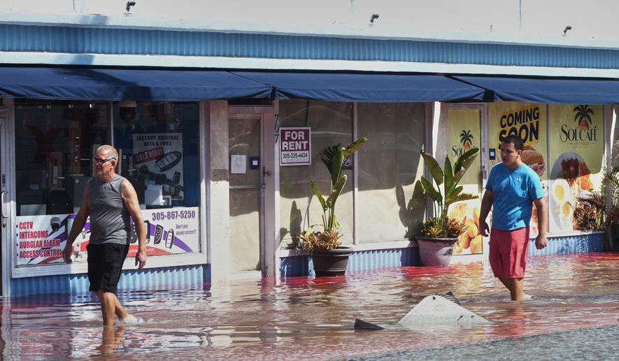

Heavy rain and flash flooding are expected along Florida’s east coast through Friday, with the highest risk from the Jacksonville area south to Port St. Lucie, according to the National Weather Service.
Floodwater shut down roads, stranded vehicles and entered homes in the area on Tuesday night.
The Weather Prediction Center has a moderate risk, level 3 of 4, of flash flooding on parts of the east-central and northeast coast from Wednesday through Friday. The state emergency management division said it’s highly unusual, outside tropical systems, to see multiple days of moderate flash flood risk in Florida.
People were interested in these podcasts
Forecast totals vary by region. NWS Jacksonville forecasts 4 to 8 inches through Friday evening, with isolated totals of 8 to 12 inches possible.
NWS Miami said the likeliest totals along the southeast coast are 2 to 4 inches through Friday, with a 10% chance of 6 to 10 inches.
The ground is already saturated. Melbourne had its rainiest day on record on Nov. 2, when 11.5 inches fell. The St. Johns River near Cocoa is in major flood stage at about 17.1 feet.
Flood watches are in effect through Thursday evening for Palm Beach County and through Friday night for Okeechobee County and the Treasure Coast.
A flood watch also remains in effect through Friday evening for Duval, Clay, St. Johns, Flagler and Putnam counties.
The heavy rain could last until Saturday.
A low-pressure system is expected to move from the eastern Gulf of America across the peninsula, and models show such a system forming east of Florida by late Friday or early Saturday.
The National Hurricane Center said tropical cyclone formation is not expected in the Atlantic Ocean, Caribbean Sea or Gulf of America over the next seven days.
Contact the author


Please read our comment policy before commenting.