



1. What happened?
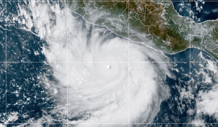
Polo grew into one of the most powerful Pacific cyclones in decades, reaching Category 5 strength on Tuesday before weakening slightly to a Category 4 hurricane with maximum sustained winds of 150 mph. The storm was located about 165 miles south of Zihuatanejo and was expected to turn northwest and skirt Mexico’s southwestern coast without making direct landfall.
2. Why does this matter?
Even without making landfall, Polo poses serious risks: Hurricane-force winds extend up to 40 miles from its center, and tropical storm-force winds reach as far as 105 miles out. Forecasters warned that heavy rain, flash flooding, mudslides, dangerous rip currents and rogue waves could still threaten coastal communities in Guerrero, Michoacán, Oaxaca, Colima and Jalisco states.
3. Who is involved?
Key figures include Mexican President Claudia Sheinbaum, who said experts did not expect Polo to touch land, and the U.S. National Hurricane Center in Miami, which is tracking the storm and issuing warnings. Scientists Kristen L. Corbosiero of the University at Albany and Philip Klotzbach of Colorado State University offered analysis on the storm’s unusual strength, while Michoacan restaurant owner Concepcion Lopez Villegas described the fear and preparation happening on the ground.
4. What comes next?
Forecasters expect Polo to remain a powerful major hurricane over the next several days as it moves west-northwest, with fluctuations in intensity likely. Meanwhile, a second system, Odalys, strengthened into a Category 1 hurricane far off Mexico’s coast but is not expected to threaten land.
5. Why is this storm historically notable?
Polo became the third Category 5 hurricane of the Pacific season, following Genevieve and Lowell earlier this year, and its winds rank among the strongest recorded in the region in recent decades, comparable mainly to 2015’s Hurricane Patricia. Scientists attributed the storm’s rapid intensification to El Nino, which has warmed Pacific waters and created ideal conditions for hurricanes to strengthen quickly — the same pattern that has contributed to this year’s record-long start to the Atlantic season without a single hurricane forming.
For more on this report, read “Polo off Mexican coast is among ’the strongest storms ever’ as Odalys becomes a hurricane” from The Associated Press, published on The Washington Times.
This article was constructed with the assistance of artificial intelligence and published by a member of The Washington Times' AI News Desk team. The contents of this report are based solely on The Washington Times' original reporting, wire services, and/or other sources cited within the report. For more information, please read our AI policy or contact Steve Fink, Director of Artificial Intelligence, at sfink@washingtontimes.com
The Washington Times AI Ethics Newsroom Committee can be reached at aispotlight@washingtontimes.com.

Please read our comment policy before commenting.